
Aerial Environmental Monitoring
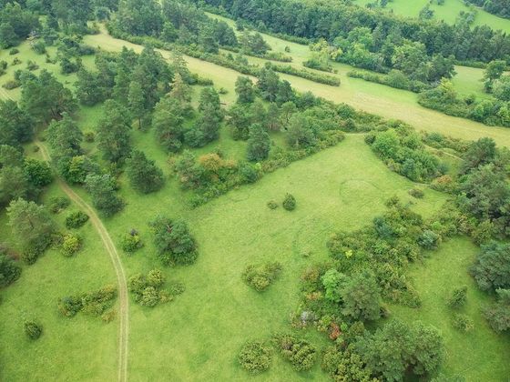
The interpretation of Aeria photographs and videos has become one of the most popular and highly valuable tools for environmental monitoring. Aerial photography or drone videography makes it possible to monitor vast surfaces quite easily. This has proven to be a vital tool for habitat mapping and monitoring, ecological research projects, monitoring land-use changes, and general environmental monitoring. As a government agency, research body or student or researcher intending to embark on an environmental monitoring project, you can benefit from hiring the services of an aerial survey company like us.
Benefits of Aerial Environmental Monitoring
The benefits of using drones in the fields of environmental monitoring and conservation are quite enormous. More researchers, students, environmental engineers, and so on are starting to see the use of drones for their projects. Unmanned aerial vehicles provide quick and cost-effective environmental insights on demand. They are also quite valuable for mapping in areas that are otherwise difficult to assess. They find application for glacial modeling and tracking coastal erosion. Wildlife conservation experts can also make use of drones for species identification and for assessing species populations.
Forest Monitoring
Tropical forests are critically important for global carbon cycling. Forests are also home to two-thirds of all known animal and bird species. However, this vital role is being threatened by deforestation globally. This is an urgent challenge for environmental conservationists as tropical deforestation is one of the leading causes of biodiversity loss and a major contributor to global warming. Drone photography and videography makes it possible to easily monitor real-time changes in forests and provide data for the mapping of land cover. This makes it easier to monitor species distribution and population dynamics. It makes control and monitoring of illegal forest activities possible.
Wildlife Research
Environmental aerial photography is also valuable for wildlife population and ecology research. For effective wildlife research, accurate spatial data and information about various habitats and the distribution of various species within them are required. Drones can provide an effective and low-cost way of obtaining such information quite seamlessly. An autonomously controlled unmanned aerial vehicle can be used to capture high-quality photographs and progressive-scan video of various habitat and the wildlife species they host.
Our Environmental Aerial Survey services
At
Kitchener Aerial Surveying, we believe in using the technology to make the environment safer and protect various animals and plant species. Our drone solutions are designed to simplify the collection of geo-spatial data needed by professionals for efficient environmental monitoring and conservation. Various environmental professionals like researchers, conservationists, environmental engineers and are beginning to turn to drones in place of terrestrial surveying tools that are a lot more expensive and provide imagery with less coverage and lower imagery. We believe that through our efficient drone services, we can make it easier for professionals to make a better decisions and do so faster.