
Construction Surveying and Inspections
Several factors contribute to the growing adoption of aerial photography in the construction industry. One of the main reasons why players in the construction industry are turning to drones for surveying and inspection is because it provides a safer and cheaper means of collecting accurate data that optimize operations. Various stakeholders involved in construction site management can benefit from aerial construction and surveying for property assessment as it provides access to data they need to manage resources efficiently. It also makes it possible to gather data on the site that can be used anywhere and accessed by professionals that are not even on-site. Using drones to inspect construction sites also provides a much safer work environment on-site since workers can now inspect those hard-to-reach places safely with drones and no ladders or scaffolding required.
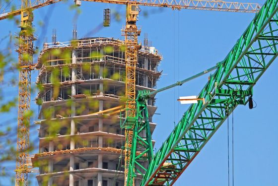
Inspection of buildings and structures
Traditionally, to inspect buildings and structures, construction workers will have to build scaffolding and spend a lot of time to carry out inspections on-site. The use of aerial inspections drastically reduces what can be accomplished with less risk and less time involved. With drones, you can get high-quality images which can then be used to carry out a detailed analysis of the structure. The drone will be flown in a predefined pattern to capture images of various parts of the structure. These images will then be analyzed by professionals involved like the site manager, engineer, or building inspectors. Kitchener Aerial Surveying provides a safe way to inspect buildings and structures with more in-depth analysis than what cannot be completed on the field. The drone images can also serve as a record for the owner of the building for several purposes including insurance, and other future uses.
Drone Roof Inspections
The alternative to drone roof inspections is to manually observing the roof from ground level or physically climbing up the roof. This is not only difficult and expensive, but the fact that some areas of the roof will be inaccessible means the process is generally high-risk without being effective. Our drone roof inspection services are the best alternative. This allows us to capture quality photos and videos of the roof that can then be analyzed in the safety of an office. In addition to regular cameras, we also take thermographic images which makes it possible to detect water filtration and other areas of the building that may be unobservable in the traditional roof inspection.
Drone land surveying
Drones can be deployed over a specific site to carry out detailed measurement. This provides access to geo-referenced images which makes it possible to create and compile a wide range of detailed maps that will be useful to the construction project. Topographic maps of the site can be prepared using the data collected. A digital terrain model complete with contour lines, reference points, and so on can be prepared using specialized software.
Construction inventory tracking
Drones can be used to conduct inventory tracking on construction sites. To do this, a drone is flown over and around the stockpile of materials, and a series of images are captured. This is then processed into a 3D point data and a volumetric analysis is carried out to determine the exact quantity of the material on site. This makes it possible to track material usage and for accurate reporting of the usage of these materials at any given time on site.